Now and then updates are added to this post, so scroll down aways for those...
Here' s a site with maps...it looks to have begun in the Tuolumne River Gorge thereabout along 120 nearing Groveland, 120 being route I've often rolled along, and visit friends with home thereabout...
http://goldrushcam.com/sierrasuntimes/index.php/photos/photo-of-the-day/9548-rim-fire-near-yosemite-national-park-modis-map-and-fire-photos-for-thursday-august-22-2013
and here is where those maps came from:
http://activefiremaps.fs.fed.us/
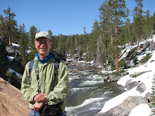
which is a link I should put on the side mast...my sister was photog for Fallbrook newspaper, and this time of year, I'd ride along, or just look down the street, recalling one New Years near run thing!
update:
The Sierra Suntimes does a good job...click on the link and then click on their home button for latest...
a note to my sister after reading that update...
yes...too hot...saw on web rockslide in Kern Canyon...seems they've redirected it north, so Groveland and Pine Lake okay...watched clip at that Suntimes site I linked taken by tanker dropping retardant...it's burning up around five six thousand, where forest is thickest...click on Suntimes home button for latest...
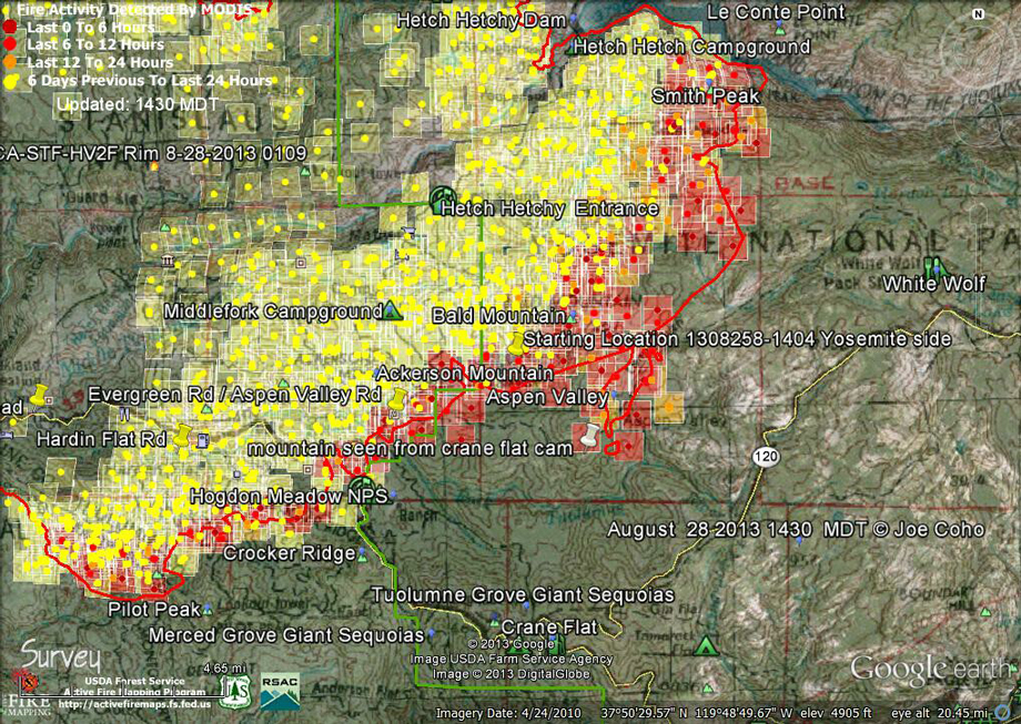
http://goldrushcam.com/sierrasuntimes/index.php/photos/photo-of-the-day/9673-rim-fire-near-yosemite-national-park-perimeter-map-for-wednesday-august-28-2013

http://www.topoquest.com/map.php?lat=37.93750&lon=-119.61766&datum=nad27&zoom=16&map=auto&coord=d&mode=zoomin&size=m
update, Wednesday...
SierraSunTimes didn't have much this afternoon, but the map, posted up above, and that link is just above here, and the second map is from topo site, see link, and it shows the hiking trails that go down into the Tuolumne Canyon, and those familiar with this trail, and with maps, can see from how close the topo lines are together how steep the trail is coming from White Wolf...it's about a five mile downhill hike to Pate Valley, and about a five hour hike up from Pate Valley!...I thought today the fire would be controlled, and stopped at Hetch Hechy, and maybe it is...it is very hard to sort through the media's reports!...after Hetch Hechy, I think the the only fall back is White Wolf and 120, by this I mean where resources can be staged, and a fireline made of sorts...when I was a kid, there were firebreak bulldozed dirt roads all over the local foothills here in Orange County, now a kinda moot observation, as there are homes and roads all over the foothills now!...trying to work on my house hereabout, I can go like twenty minutes before feeling faint, the heat, and my age!, being cause, so my hat's off to the some five thousand fire fighters, it must be a most difficult and trying effort!...often at Last Chance I've seen them come in for dinner and such, the strong scent of pine turpentine smoke in the room...here's link to wed. afternoon map...
http://goldrushcam.com/sierrasuntimes/images/stories/images2013/August/Rim-Fire-Modis-Fire-Ignitions-1430-MDT-Aug-28-2013-Yosemite.jpg
http://goldrushcam.com/sierrasuntimes/images/stories/images2013/August/Rim-Fire-Modis-Sat-8222013.jpg


2 comments:
It must be wild for you seeing this shortly after you left the area you know so well.
Yes...it has my attention! I follow my friends facebook posts routinely--hereabout outside has change, or changed back to what it once was!, but inside I'm there in the Valley, and will always be...
Post a Comment